Experience the sheer beauty of a nearly forgotten ancient trade route connecting Zanskar to Lahaul.

Miyar Valley Trek Overview:

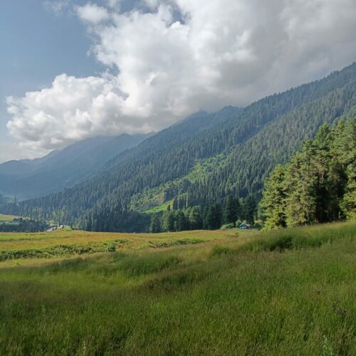
In the heart of Lahaul, between the Zanskar and Chamba regions of the Himalayas, lies an offbeat trail brimming with countless wildlfowers. Hues of red, yellow, pink and blue dot the expansive grasslands and meadows as you quietly walk along an age-old glacial stream with boulder fields in the distance. Welcome to the enchanting setting of Miyar Valley! Also known as Lahaul’s ‘Valley of Flowers’ and for good reason, this S-shaped valley was an ancient trade route connecting Ladakh to Himachal Pradesh via the famed high mountain pass of Kang La (17,600ft).

One of the best kept secrets of the Central Himalayas, getting to Miyar Valley was not only extremely tedious and risky, but also impossible for six months when Rohtang Pass was snowed out. With the Atal Tunnel finally connecting Lahaul and Spiti to Manali for year-round travel, mountaineers, climbers and trekkers finally began to arrive! To get to its base village of Khanjar, you travel from the lush green hillsides of Kullu to the dry, arid and jagged mountains of Lahaul. The road takes you along the Chenab river and past the confluence of the Chandra & Bhaga rivers at Tandi, to which this valley owes its name (Chandrabhaga).

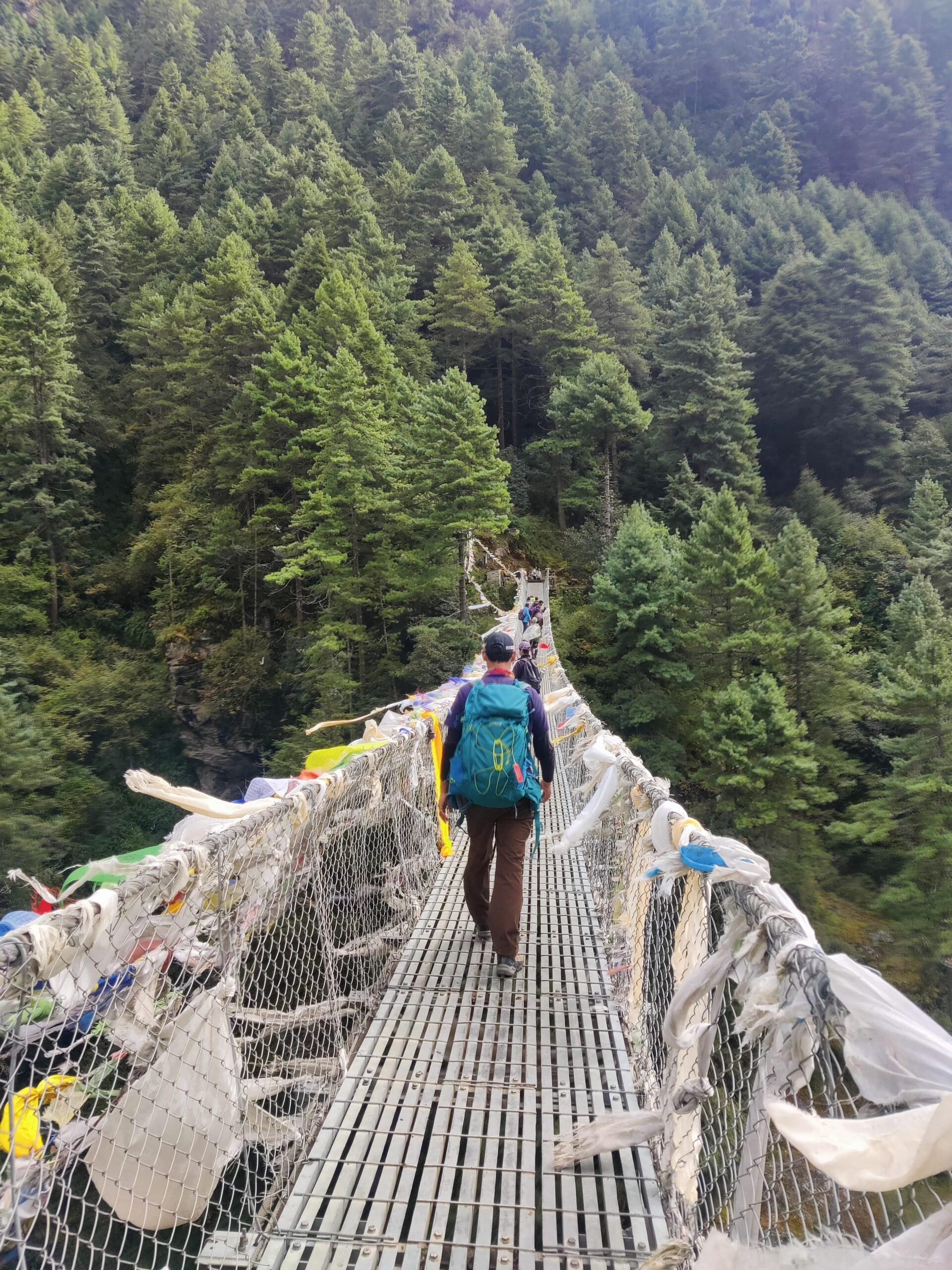
As you undertake this journey, what lies ahead of the wooden bridge at Khanjar, is nothing short of breathtaking! This gently ascending trail meanders along the Miyar Nallah, and takes you across a seemingly endless montage of the prettiest meadows one can step onto! Your destination is the second longest ‘moving river of ice’ in Himachal – the nearly 30km long Miyar Glacier! At the snout of this ever-receding marvel lie the crowning jewels of this trek. The seven sacred, emerald-green glacial lakes, traditionally known as ‘Kesar Yon Chhap!’

The 65 kilometers from the hamlet of Khanjar to Kesar Yon Chhap and back form a uniquely beautiful trail with some of the most mesmerizing sights, sounds and experiences you can have in the Indian Himalaya. Don’t you dare miss out!

Into the Heart of Lahaul – Highlights of the Miyar Valley Trek!

The Miyar Valley takes you into the inner folds of Lahaul and allows you to experience a stunning variety of geographical features – from glacial lakes, never ending grasslands and meadows to a stark range of mountains topped with sharp ridgelines and snow-capped summits! Here are some of the major points of attraction you wouldn’t want to miss out on:

  • Kesar Yon Chhap translates to “Seven Sacred Waters” in the local dialect. This is a stunning amphitheater of seven glacial lakes shimmering in shades of emerald green, turquoise, and deep blue—found near the snout of the Miyar Glacier.
  • En route, you’ll spot a couple of prominent peaks of the Chandrabhaga range, including Tharang (6,066m) and Mt. Menthosa (which at 6443m is the  second-highest peak in Lahaul).
  • In the initial days of the trek, after leaving Khanjar, you’ll pass through the breathtaking Chhudong Meadows, blanketed in wild grasses and flowers.
  • A long day’s walk takes you from Yolling to Zardong, a campsite near the Miyar Nallah, known for its surreal boulder-strewn landscape—a climber’s paradise!
  • As you drive into Khanjar and begin the trek, you’ll walk past Miyar’s traditional farmlands. Locals cultivate barley, lettuce, potatoes, buckwheat, peas, and several medicinal herbs native to the region.
  • If you visit in the right season (late June to mid-August), the valley bursts into bloom with wildflowers—thanks to the snowmelt. Expect to see blue poppies, primulas, potentillas, gentians, and orchids in an explosion of colors across the meadows and riverbanks.
  • Wildlife sightings may include marmots, flocks of yellow-billed choughs, Himalayan brown bears, and migratory birds.
  • Pause at the Buddhist stupas at Gompa, reflecting the deep-rooted Tibetan Buddhist culture of the valley.
  • En route to Miyar, soon after you cross the Atal Tunnel, you also get a wonderful glimpse of the scenic Khagling Waterfall near Sissu.

How do you reach Miyar Valley?

The Miyar Valley trek begins from the quaint hamlet of Khanjar which lies roughly 140kms north-west of Manali.

  • One can reach Manali by road with Delhi and Chandigarh being the usual locations most people choose to begin this journey from. Alternatively you can also fly to Bhuntar Airport in Kullu which is roughly 60kms away from Manali. Please be aware that Bhuntar is a small airport and flights are scarce and generally quite expensive.
  • Departing from Manali, we drive to Khanjar via the Atal Tunnel crossing over from the Kullu region to a starkly contrasting landscape in the Lahaul & Spiti region of Himachal.
  • From here we move towards the village of Udaipur from where we turn into the road towards Miyar valley. En route we will be crossing the famous towns of Sissu and Tandi where we can stop to witness the confluence of the Chandra & Bhaga rivers which form the beginning of the Chenab river.

Best Season to do the Miyar Valley Trek!

The best time to visit Miyar Valley is from mid-June to early September, with the absolute peak season falling between July and August. During this window, the snow has largely melted, the high-altitude passes are accessible, and the valley transforms into a tapestry of wildflowers, lush meadows, and gushing streams.

While June offers clearer skies and snow-dusted peaks, early September brings cooler weather and changing hues as the valley slowly prepares for winter. Outside of this summer window, access becomes difficult due to snow-covered passes and harsh conditions. So for trekkers, botanists, and photographers alike, July & August stand out as the most rewarding months to experience Miyar Valley.

Challenges on the Miyar Valley Trek – What To Expect?

The Miyar Valley trek is considered a moderately difficult trek that does not require technical or mountaineering skills. Listed below are some key points to keep in mind when planning to attempt this trek:

  • The roadhead for the trek, Khanjar, is located at an elevation of 3,520 meters (11,500 feet)—a fairly high altitude. Since we’ll be driving up from Manali (2,050 meters / 6,725 feet), our bodies will begin to gradually acclimatize. However, it’s important to pay close attention to your health, especially during the first day or two. Our team will check in with you daily to monitor your condition.
  • Over the course of the trek, we gain only about 500 meters of elevation (for reference, Kesar Yon Chhap, the highest point of the trek, sits at 4,020 meters / 13,200 feet). What’s more important to be prepared for is the length of each day’s walk. On average, we’ll be covering 8–12 kilometers per day on a gradual incline. While the days will be long in terms of distance, the elevation gain remains moderate.
  • Along the trail, you’ll also encounter a few tricky sections, including crossings of a few boulder field and several glacial streams and rivulets feeding into the Miyar Nallah.

Upcoming Treks

No trek dates available.

Why Choose Us?

trekking

India's only adventure company led by Everest summitteers

experience

14+ years of Himalayan experience

Tripadvisor Travellers' Choice Awards

5-time Travellers' Choice Award Winners

protection

100% safety record

Register now for the Miyar Valley Trek!

Send us an enquiry and we'll get back to you immediately

Brief Itinerary

  • Day 1 - Arrival in Manali. Explore the town and complete any last minute gear rentals/purchases. 
  • Day 2 - Drive from Manali to Khanjar (via Atal Tunnel). Trek to Doksa and Camp Overnight!
  • Day 3 - Trek from Khanjar to Yolling 
  • Day 4 - Trek from Yolling to Zardong
  • Day 5 - Trek from Zardong to Palpu via Kesar Yon Chhap
  • Day 6 - Trek from Palpu to Gompa 
  • Day 7 - Trek from Gompa to Tharang
  • Day 8 - Trek from Tharang to Khanjar and Drive to Manali
  • Day 9 - Check Out & Departure from Manali

Inclusions & Exclusions

Trip Cost Includes:

  • 2 nights hotel stay in Manali - (Day 1 & Day 8) on bed & breakfast plan. 
  • Travel from Manali to Khanjar (Base Village for the trek) and back to Manali 
  • Experienced and qualified guides, kitchen staff for the trek.
  • All Necessary Permits
  • All Accomodation on trail - twin sharing in tents
  • All meals from Day 2 to Day 8
  • Porters/Mules to carry backpacks/duffel bags during the trek (upto 10 kgs only per person)

Trip Cost DOES NOT Include:

  • Travel to and from Manali
  • Lunch & Dinner on Day 1 and Day 9
  • Excess baggage to be carried by porters beyond specified weight limit. 
  • Tips for guides/porters/cooks (mandatory)
  • Any personal clothing or equipment.
  • Cost arising out of extension or reduction or change of itinerary, due to medical emergencies/personal reasons/force majeure etc.. 
  • Upgrade to single occupancy in hotels on Day 1 & Day 8  
  • Upgrade to single occupancy tents
  • Travel/Adventure Insurance
     

Things to carry

Download as PDF

Apparel

  • Thermals - 1 pair top and bottom
  • 4 t-shirts or long-sleeve shirt (preferably dryfit/quickdry)
  • 2-3 pairs of trekking pants (no jeans)
  • 1 Sweater/Sweatshirt
  • 1 Fleece Jacket
  • 1 Down Jacket
  • 1 Waterproof Layer like raincoat or wind-cheater
  • 1 pair of hiking boots
  • 1 pair of comfortable sandals/floaters/sneakers
  • 6-8 pairs of cotton socks (for day)
  • 2 pairs of thick/woollen socks (for night)
  • Gloves - liner and outer
  • Sun cap/hat
  • Woollen cap
  • Buff/neck warmer


Accessories

  • Duffel bag / Rucksack for off loading. Maximum 10 kgs allowed. 
  • Daypack / Backpack (20-30L capacity)
  • 2x 1L Bottles (to carry drinking water)
  • Torch + Batteries / Headlamp
  • Trekking Poles (if you use them)
  • Sunscreen
  • Sunglasses
  • Moisturiser
  • Hand Sanitiser
  • Any personal medication 
  • Personal Toiletries
  • Trail snacks
  • Power bank for electronics


Fitness

Download as PDF
  • There are three main aspects of training to focus on – strength training, cardiovascular training, and trekking + trekking alternatives.
     
  • Strength training involves training different muscle groups, so that they can become stronger. There are different exercises for each muscle group, and working them all out 2x-3x a week should be enough to help you get comfortable trekking.
     
  • Legs / lower body - exercises like squats, glute bridges, step ups and leg presses with help you develop stronger muscles in the lower body. 

    Core - Exercises like planks, bicycle crunches and leg raises can help with core stability; Pilates is also a core-intensive type of workout that will help.

    Upper body - Bodyweight exercises like push-ups, pull-ups and dips will help develop these muscles. You can also use resistance bands or light weights to develop them further.
     
  • It’s vital to do plenty of cardio training before your trek, so that you can get the most out of your experience
     
  • Running - This is the most recommended form of cardio activity, as it activates a lot of the same muscles as trekking. Being able to run 10km in 60 minutes will allow you to get the most out of your trek.

    Cycling / Swimming - If you have knee issues, or don’t enjoy running, you can also opt for cycling and swimming. Being able to cycling 30-50km or swim for 30-40 minutes, thrice a week, should be good to help you with treks like EBC.

    HIIT training / Crossfit - Another option to level up your cardio training is to opt for high intensity aerobic exercises like HIIT or Crossfit, 2-3 times a week
    The aim is to get your heart rate up, so you do not get winded on long days of trekking
     
  • Hiking
    Try to get outdoors and go for a hike on the weekends! Uphill trails of 4-8 kilometres are will help you get used to trekking. Make it a point to carry a loaded backpack, and walk in your trekking shoes.
     
  • Hiking Alternatives
    Climbing stairs, and using the treadmill or stairmaster on an incline, will help prepare you for treks. Make it a point to carry a loaded backpack so that you can get used to the extra weight; and use your trekking boots, so that you can break them in and walk comfortably.
     
  • If you’re confused with all this information, no need to worry! The most important thing with training is consistency, and staying injury-free. Your training week should ideally have
    Strength training - 3 sessions
    Cardio training - 3 sessions
    Hiking - 1 long session, best on the weekends
    Rest and stretching - at least 1 day

FAQs

Miyar Valley Trek

What will be the accommodation during the trek ?

In Manali you will be staying in a 3 Star Hotel on Day 1 and Day 8 on a Bed & Breakfast Plan.

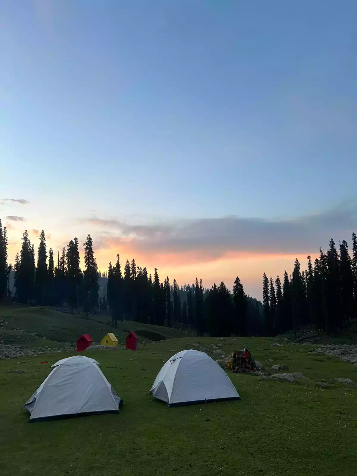
During the course of the trek you will be camping in tents on a twin-sharing basis which will have a mattress and a sleeping bag inside.

How fit should I be to undertake this trek?

The Miyar Valley trek is a moderate trail which begins at an altitude of 3520m. While this is quite high, the elevation gain on the trek is not much with the high point being Kesar Yon Chhap at 4020m.

Depite this you need to be well prepared physically and mentally, as the first day or two could be a shock to your system otherwise due to the elevation. The trail requires you to walk anywhere between 8-12 kms through very gentle inclines each day and will therefore be a test of your endurance. It does not require any previous mountaineering experience as this is a walk through beautiful meadows and grasslands for the majority.

Good cardio-vascular conditioning and a strong lower body will ensure your trek is comfortable.

How many days long is the Miyar Valley Trek and where does it begin and end?

At Adventure Pulse, we follow a standard 9-day itinerary for the Miyar Valley trek.

On the morning of Day 1 - you need to reach Manali in Himachal Pradesh
The most convenient way to reach Manali is by road via Delhi and Chandigarh. There are regular buses that run on this route. Alternatively you can fly in to Bhuntar Airport (60kms from Manali) and drive down.

The roadhead for the trek is a village called Khanjar in the Lahaul region.
It is a 6 hour/140 km drive from Manali which we undertake on Day 2 of our itinerary.

Days 3-8 involve trekking and we return to Manali on the night of Day 8 with your departure on the morning of Day 9.


What are the food arrangements?

On the trekking days, all your meals are included, and are usually a good mix of Indian and continental food. Our cooks are very experienced and will be happy to entertain any particular requests you may have for your meals. All the meals are served in the common dining tent.

On Day 1 - Lunch & Dinner on Day 1 can be ordered ala carte in the hotel or you can visit Mall Road, Vashist and Old Manali to try the local cuisine.

Will I be able to take a shower or bath during the course of the trek?

Regular shower facilities will be available in the hotel in Manali. But while we are higher up in the mountains, a shower facility is not available for the climbing period.

What are the medical / emergency precautions taken?

  • Adventure Pulse requires each of its clients to provide a medical fitness document before joining the group. This serves a dual purpose of allowing us to be prepared for any medical eventuality as well as gives you a reality check of where you stand physically.
  • Our team is well qualified for any First-Aid procedures if required on the way, having been trained in first aid and certified as Life Savers & Life Guards.
  • In addition a comprehensive medical & first aid kit is carried at all times.
  • In case of dire necessity, Adventure-Pulse makes provisions to ensure emergency evacuation to the nearest hospital, where the patient would be transported on a pony with the team straight to the nearest hospital for medical treatment. Rest assured, this is option has never been exercised till date and we are proud to say that we have a 100% safety record.
  • Adventure Pulse team also carries an oxygen cylinder for emergency purposes. 

<< 1 >>


Detailed Itinerary

Day 1

Arrival in Manali (2050m)

Day 2

Drive from Manali (2050m) to Khanjer (3,500m)

Maximum Elevation: 3,500 m / 11,483 ft Drive Distance: ~140 km Driving Time: 5–6 hours Today we officially set course, beginning our journey from Manali and passing through the Atal Tunnel — a gateway into an entirely different landscape. On the other side lies Lahaul, a high-altitude desert full of raw, mystical beauty. The dramatic shift in climate, terrain, and vegetation is immediately apparent. As you travel along the Chenab River, spot iconic sites like the Triloknath Temple perched at Tunde and the confluence of the Chandra and Bhaga rivers at Tandi. The region around Tandi offers a striking view of the intersection between Kullu’s lush green valleys and Lahaul’s stark, folded sedimentary mountains. Another major highlight along the way is driving past the Khagling or Sissu Waterfall. The road eventually leads to Khanjer — the last inhabited village in Miyar Valley — reached by crossing a wooden suspension bridge hanging over the icy cold Miyar Nallah.

Day 4

Doksa to Yolling (3,600m to 3,765m)

Maximum Elevation: 3,765 m / 12,352 ft Trek Distance: 9.2 km Trekking Time: 5–6 hours Start your trek with a gentle ascent through terraced fields of barley, lettuce, potatoes, and several medicinal herbs. Farming here is only possible between June and September, and the locals have adapted to these short growing windows. The trail follows a series of switchbacks as you gradually gain altitude. You’ll walk alongside the Miyar Nallah, occasionally spotting marmots and flocks of choughs. Eventually, you reach Yolling — a beautiful open meadow near a flowing stream, sometimes used by villagers as a makeshift cricket ground. Rock faces tower above the campsite, popular among adventurous climbers. Near Yolling, you’ll get your first clear glimpse of Menthosa — the second-highest peak in Lahaul — revered locally and considered a major highlight of Miyar Valley.

Day 4

Yolling (3,765 m) to Zardong (3,860 m)

Today’s route involves more varied terrain. Start with a flat walk before descending to a bridge crossing the Miyar stream. From there, a steep 20-minute climb takes you past Gompa Nala and a shepherd’s shelter near Gompa Lake — a small, serene glacial pool. The trail dips into meadows and then enters a tricky section filled with loose boulders and narrow ridgelines. You’ll have to navigate carefully, but the landscape compensates — pyramidal snow peaks loom all around, and wildflowers blanket the valley floor. The trail finally levels out into a riverside plain with beach-like sand underfoot and the calming sound of gushing water accompanying your every step. Zardong is also famous for being littered with boulders of all shapes and sizes which is the ultimate playground for climbing enthusiasts.

Day 5

Zardong (3,860 m) to Palpu (3,890 m) via Kesar Yon Chhap (4,025 m)

Maximum Elevation: 4,025 m / 13,205 ft Trek Distance: 12.5 km Trekking Time: 7–8 hours We now walk along the Miyar Nallah, widening and tranquil, its milky, glacial flow hinting at the source ahead. Palpu, your next campsite, lies beneath the rocky ridges of Castle Peak. If skies are clear, expect excellent views of both Castle Peak and Menthosa. From here, an optional but rewarding detour leads you to the snout of the Miyar Glacier. The path follows the river through moraine and stream crossings, finally reaching Kesar Yon Chhap — a group of seven sacred glacial lakes. Spend some time absorbing the atmosphere here — the snout of the glacier lies just ahead, its icy mass feeding the river that has accompanied your journey so far.

Day 6

Palpu (3,890 m) to Gompa (3,915 m)

Maximum Elevation: 3,915 m / 12,844 ft Trek Distance: 12.5 km Trekking Time: 5–6 hours Return from Palpu and descend slightly towards Gompa. Today’s trek is relatively easy, with most of the path being flat and scenic. The trail hugs the river for long stretches, weaving past soft meadows and high cliffs. The terrain alternates between open grasslands and small boulder fields. The remote silence of the valley is broken only by wind, water, and the occasional flock of birds or yaks grazing near the trail. Gompa campsite is another beautiful riverside location, flanked by jagged mountain faces.

Day 7

Gompa (3,915 m) to Tharang (3,740 m)

Descend to: 3740m / 12,270 ft Trek Distance: 7.5 km Trekking Time: 5 hours Today, retrace your route across Chhudong’s vast green meadows. The walk is pleasant, with minor undulations and a mostly clear trail. As you continue, the valley narrows and the path takes you past glacial streams flowing from valleys to your right. Though the trail flattens out in patches, you’ll still navigate boulder zones and small water crossings. Expect short bursts of scrambling before reaching Tharang, a peaceful riverside camp surrounded by silent cliffs and gurgling water.

Day 8

Tharang (3,740 m) to Khanjer (3,500 m) and Drive to Manali (2,050 m)

Descend to: 3,500 m / 11,500 ft Trek Distance: ~7.5 km Trekking Time: 4–5 hours Drive Distance: 140 km Driving Time: 5–6 hours Begin your final descent through the now familiar yet equally jaw-dropping landscapes of the offbeat Miyar Valley — the meadows, farms, and river now etched in your memory. Reach Khanjer by mid-day and cross the suspension bridge for the last time. From here, the drive back to Manali begins, taking you once again through the surreal transition between barren Lahaul and green Kullu via the Atal Tunnel.

Day 9

Departure from Manali

[bold_timeline_item_button title=”Expand” style=”” shape=”” color=”” size=”inline” url=”#” el_class=”bold_timeline_group_button”]

Premium Services

adv-icon

What sets us apart is not only the expertise we bring to the table, but also the quality of services provided on each trek! We know what it takes to climb mountains, whether you’re 6 or 60, and look forward to providing you with services you can’t get anywhere else.

tourism

Backpack offloading

youth

Small group size

cab

Group airport pick-ups and drops

caregiver

Personalised attention

What Our Clients Say

Inquire Now


    Select Trek Dates:

    TOP